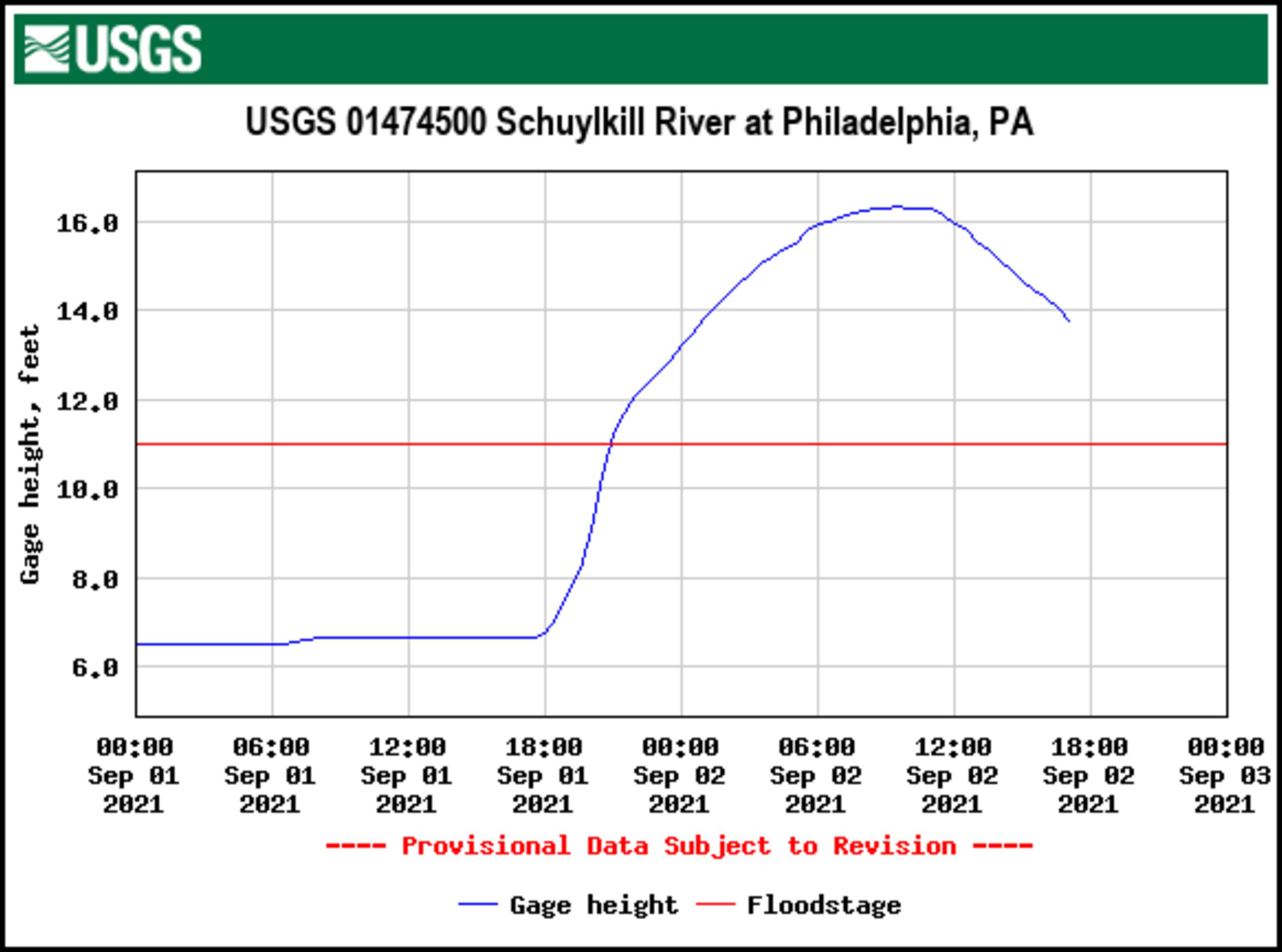
USGS flood level graph from the measuring station across from Boat House Row. Peaked at 16.35 feet on September 2, 2021 at 9:30am. This is the second highest river level ever measured. The higest was 17.00 feet on October 4, 1869.
Previous Index Next