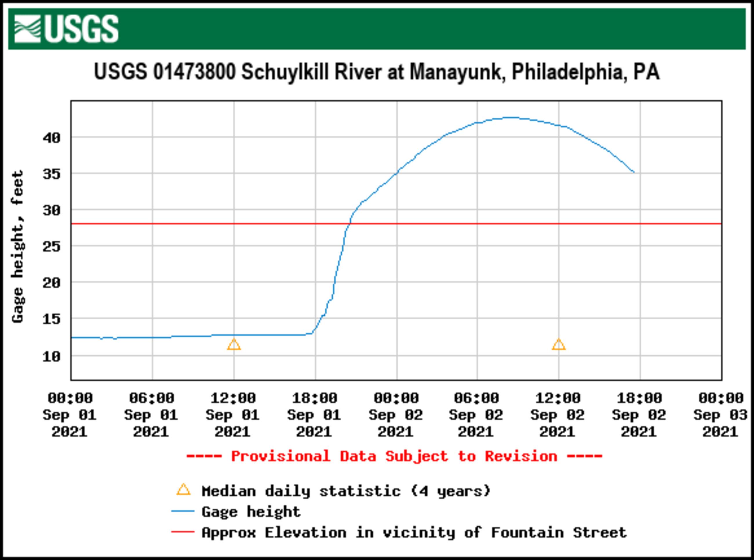
USGS flood level graph from the measuring station on Green Lane bridge. Peaked at 42.69 feet at 8:15am. The gage is only a few years old so we don't have historical river crest data.
Previous Index Next
| Previous Index Next | ||
| (or click on the image for the next) | ||
|
|
||
|
USGS flood level graph from the measuring station on Green Lane bridge. Peaked at 42.69 feet at 8:15am. The gage is only a few years old so we don't have historical river crest data. Previous Index Next |